- Doc no.
- BD-101
- Program
- Ground Truth
- Class
- Android / GNSS
- Rev.
- B
Ground Truth
A survey instrument that happens to be a phone. Built around honest uncertainty.
Overview
Sec. 1 — General descriptionGround Truth turns an Android phone into a precision point-survey tool. Stand at a point, let it collect GNSS samples, and it produces the best position the hardware can deliver — reported with its real uncertainty, never a falsely precise single number.
It is built for surveyors, land professionals, GIS and mapping hobbyists, and anyone who wants better-than-consumer-GPS accuracy without dedicated survey hardware.
Capabilities
Sec. 2 — Functional specification- Surveys a fixed point by sampling until the estimate converges to a target accuracy — with auto-complete, timeout, and manual accept.
- Live RTK corrections over NTRIP (RTCM3, v1/v2, VRS) for decimeter — and opportunistically centimeter — accuracy on dual-frequency phones.
- Coordinates in WGS84 decimal and DMS, UTM, and any EPSG-coded system including US State Plane; meters, feet, or US survey feet.
- Both heights: WGS84 ellipsoidal altitude and orthometric (sea-level) height side by side.
- Stake-out mode navigates you back to any saved point; attach photos and feature codes in the field.
- Map view with quality-tinted pins; import and export CSV, GeoJSON, and GPX.
- Built-in GNSS diagnostics — sky plot, per-satellite signal strength, constellation breakdown — so you know what your hardware can actually do.
- Captures survive a locked screen; a session runs to completion in the background.
Method of operation
Sec. 3 — Data processingA capture session records many position samples, buckets them by solution quality, and statistically filters the set into one estimate. The result is a position with a 95% horizontal confidence ellipse and 95% vertical uncertainty, plus derived CEP and DRMS figures — the numbers a professional workflow expects.
Heights are handled properly: the WGS84 ellipsoidal altitude is the primary measurement, and orthometric height is derived through the EGM96 geoid model and shown alongside. Exports are always SI and WGS84 for clean GIS interoperability, whatever units the display is set to.
With RTK enabled, correction streams from your NTRIP caster feed a vendored RTKLIB engine for carrier-phase positioning — the same technique dedicated survey receivers use.
Data handling
Sec. 4 — Custody of recordsSurvey points and photos stay on the device. No analytics, no ads, no telemetry. The only data that ever leaves the phone is the approximate position sent to your own configured NTRIP caster to request corrections — a service you choose and control.
Field views
Sec. 5 — Figures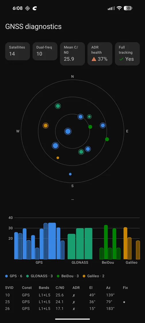
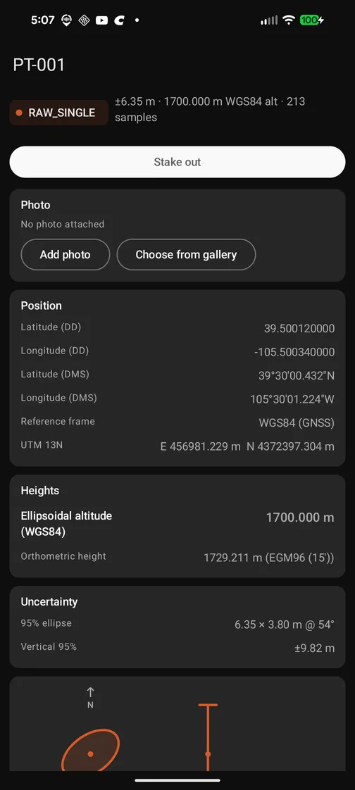
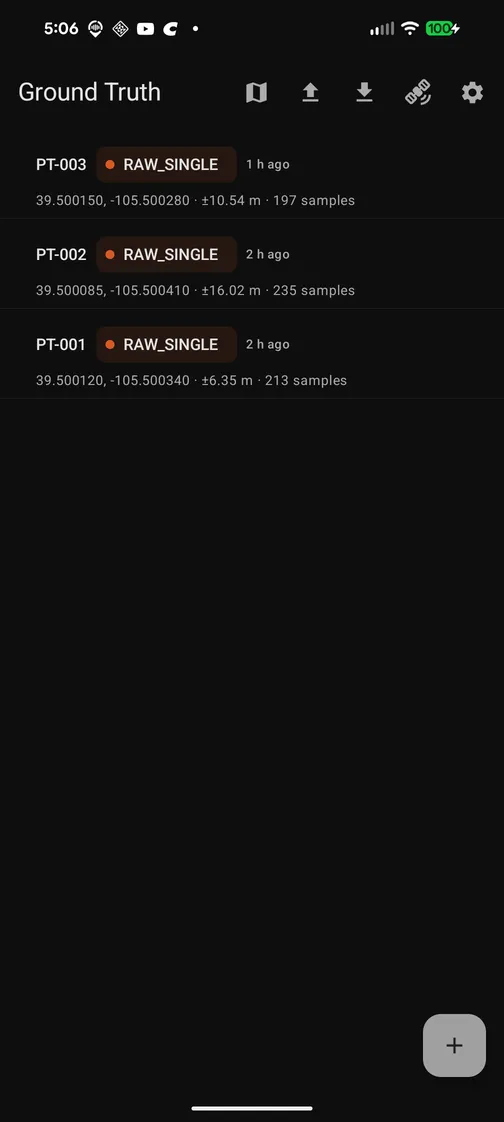
Expected performance
Sec. 6 — Accuracy envelope| Configuration | Expected accuracy |
|---|---|
| Phone, single fix | a few meters |
| Phone, averaged, open sky | sub-meter to decimeters |
| RTK, dual-frequency phone | decimeter; opportunistic centimeter |
| External receiver (planned) | dependable centimeter |
Requirements & status
Sec. 7 — DeploymentRequires Android 12 or newer. Best results come from dual-frequency GNSS phones — Pixel 5 and later, Galaxy S20/S21 and later — with Pixel the strongest platform; some devices duty-cycle their GNSS hardware and limit carrier-phase tracking.
Core surveying, diagnostics, exports, and RTK are complete and in field testing. Current work is a feature batch driven by that testing; external receiver support is next. Not yet published; documentation forthcoming.